
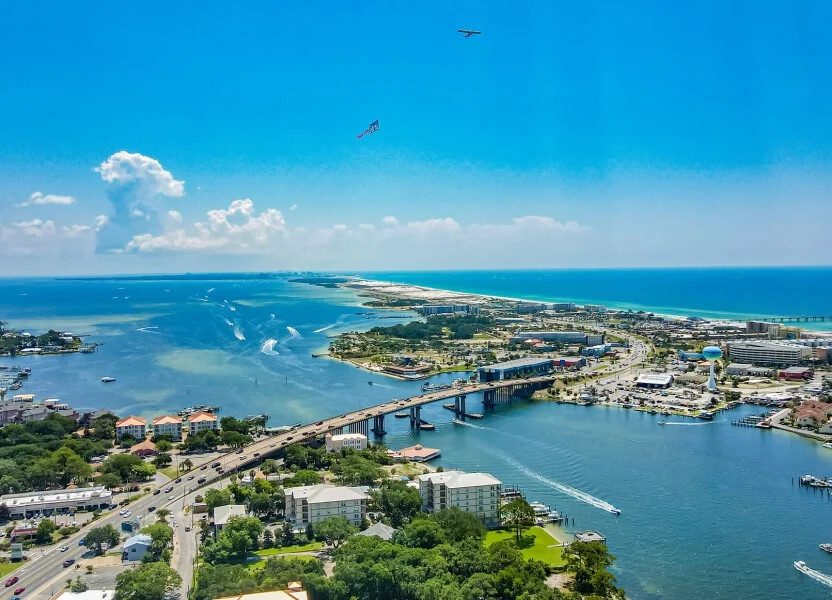
Fort Walton Beach is a compact, mostly military-adjacent city, and it doesn’t really have a bad area, but it does have is a handful of specific, documented planning issues like a bridge bottleneck that backs up into neighborhoods every summer, some of the deadliest rip currents on the Gulf Coast, jet noise from two active military bases, and a barrier island that sits under mandatory evacuation orders more often than most vacationers realize.
This guide covers these issues with what actually happens and how to plan around each one.
A few places nearby — see all in Fort Walton Beach

Fort Walton Beach Risk Factors at a Glance
| Issue | What to Know | Safer Alternative |
| Fort Walton Beach rip currents | The Panhandle sees more rip current fatalities than almost anywhere in the U.S.; Fort Walton Beach is regularly under High Rip Current Risk alerts | Always check the flag system and swim near a lifeguard tower |
| Eglin Air Force Base jet noise | Fighter jets and special operations aircraft fly regular sorties over the area, loudest near the base’s Valparaiso and Shalimar sides | Book closer to the beach and away from the base’s northern approach |
| Okaloosa Island hurricane evacuation | Barrier island communities like Okaloosa Island and Holiday Isle are under mandatory evacuation in major storms | Check your rental’s evacuation zone before hurricane season travel |
| Highway 98 Fort Walton Beach traffic | Brooks Bridge sees roughly 80,000 vehicles a day and backs up badly in summer | Use Eglin Parkway/SR 85 as an alternate route, or travel outside 10 a.m.–6 p.m. |
| Cut-through neighborhood traffic | The city closes some residential turn lanes each summer specifically to stop tourist cut-through traffic | Follow posted detours rather than trusting GPS through neighborhood streets |
Fort Walton Beach Rip Currents: The Region’s Most Serious Safety Issue
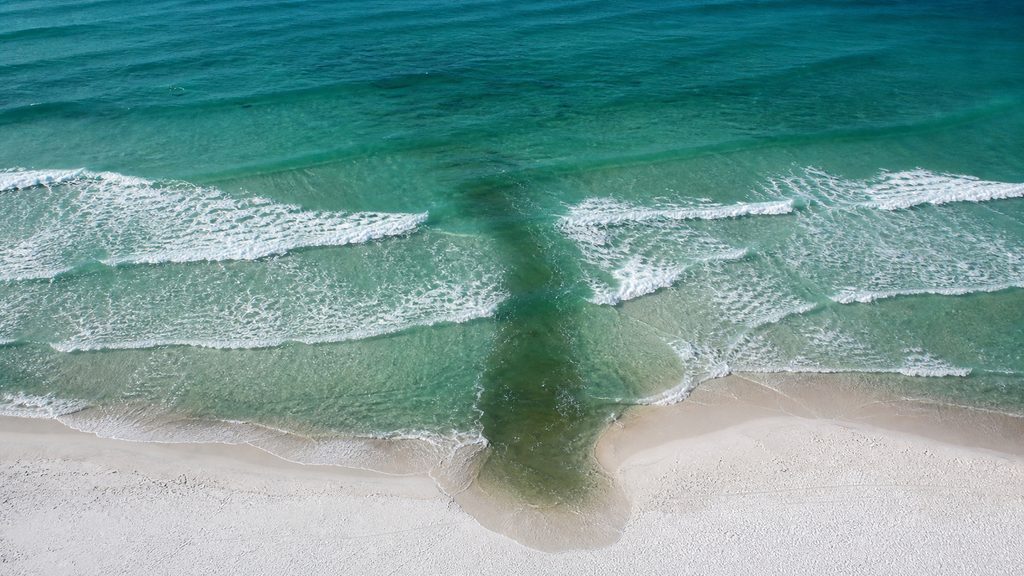
This is the most important item on this list, and is a Gulf-wide Panhandle issue that effects Fort Walton Beach. The National Weather Service has recorded 195 rip current deaths on Panhandle beaches since 2002, and Fort Walton Beach is regularly named alongside Destin, Navarre, and Pensacola Beach on High Rip Current Risk advisories during periods of strong onshore wind.
A chronic shortage of lifeguards across Panhandle beach communities compounds the risk, since not every stretch of sand is patrolled, especially outside the main public beach access points.
The beach flag warning system is the single most useful tool here:
- A double red flag means the water is closed to the public
- A single red flag means only the strongest swimmers should be in the water
- Yellow means moderate caution
If you’re caught in a rip current, the current guidance is to stay calm and float rather than fight it. The current pulls you away from shore, not underwater, and it will eventually release you. Swim near a staffed lifeguard tower when one is available, since USLA data puts the odds of drowning at a lifeguard-protected beach at roughly 1 in 18 million.
What makes Fort Walton Beach rip currents particularly dangerous is how often they strike on days that look deceptively calm. A strengthening sea breeze combined with an outgoing tide through midday and early afternoon can produce hazardous conditions even under clear skies, and out-of-state visitors unfamiliar with reading Gulf surf conditions make up a disproportionate share of drowning victims regionally. Checking the flag status when you arrive at the beach each day, not just once at the start of your trip, is worth the extra thirty seconds.
Eglin Air Force Base Jet Noise: What to Expect and Where It’s Loudest
Fort Walton Beach sits directly adjacent to Eglin Air Force Base, the largest Air Force base in the world at over 700 square miles, and Hurlburt Field, home to Air Force Special Operations Command, sits along Highway 98 between Navarre and Destin.
Locals call the resulting noise “the sound of freedom,” and it’s a real, near-daily part of life here: fighter jet sorties, and at Hurlburt, aircraft like the CV-22 Osprey and AC-130 gunship, with tracer fire sometimes visible from the highway at night.
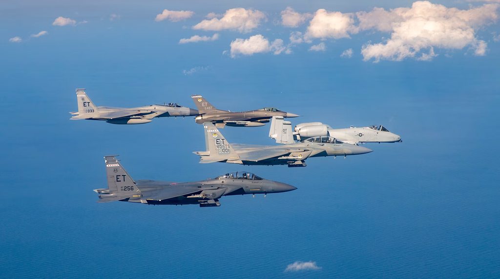
The noise isn’t constant or citywide. The Air Force largely retired the days of all-day training sorties, and jets tend to fly in bursts rather than nonstop, but it’s noticeably louder in specific pockets. Areas like Valparaiso, near Eglin’s east gate, and Shalimar, just across the bridge from downtown Fort Walton Beach, report the most consistent jet traffic overhead. If jet noise is a dealbreaker for your trip, a rental closer to the beach itself, away from the base’s northern approach paths, is the more reliable choice.



Okaloosa Island Hurricane Evacuation: What a Barrier Island Location Means
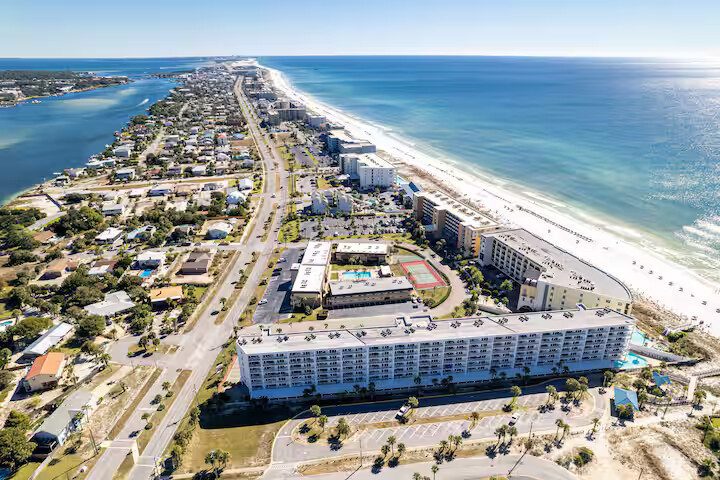
Okaloosa Island is a narrow barrier island, and that geography carries real storm exposure. During Hurricane Michael in 2018, Okaloosa Island and Holiday Isle were placed under mandatory evacuation even though the storm’s worst impacts landed well to the east near Panama City and Mexico Beach. Fort Walton Beach’s own hurricane history includes Hurricane Opal in 1995, which brought a 13-foot storm surge and washed out sections of Highway 98, and Hurricane Eloise in 1975, which produced a 14-foot surge.
None of this means Okaloosa Island is unsafe to visit day-to-day. Hurricane season runs June through November, and most trips fall well outside any storm’s path. But, it does mean booking a hurricane-season stay on the barrier island is worth a little more diligence than booking inland. Check which evacuation zone your rental falls in on Okaloosa County’s public evacuation maps, and ask your rental company directly what their storm cancellation or rebooking policy looks like before you commit to nonrefundable dates.
Highway 98 Fort Walton Beach Traffic: The Brooks Bridge Bottleneck
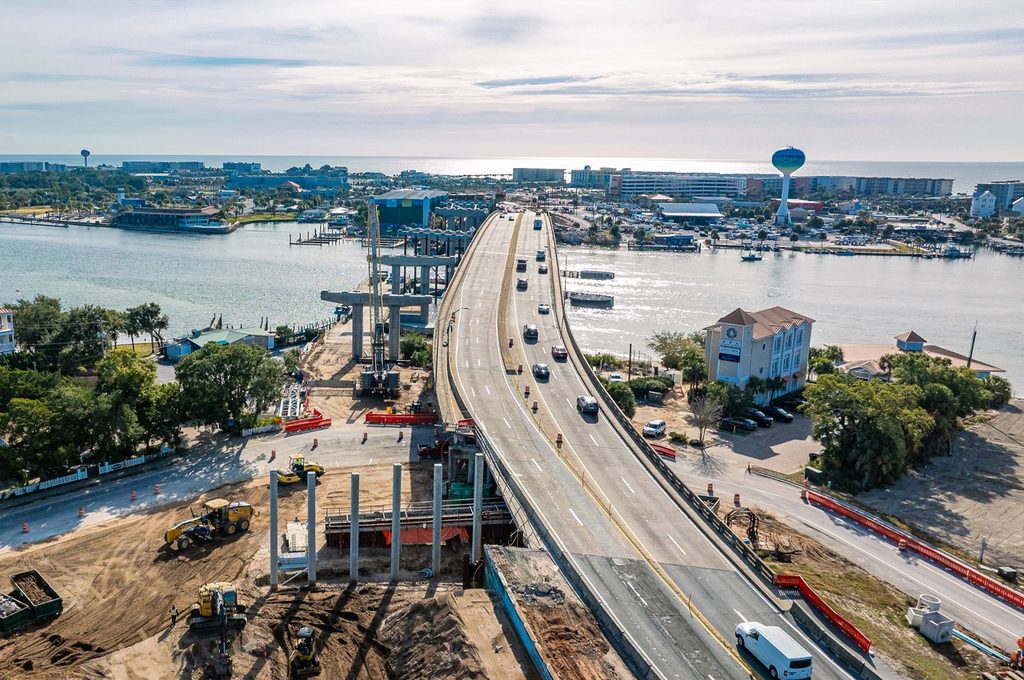
This is the most common day-to-day frustration for visitors, and it’s concentrated in one specific spot: the Brooks Bridge, where Highway 98 crosses into downtown Fort Walton Beach on the way to Okaloosa Island and Destin.
Roughly 80,000 vehicles cross this bridge daily, and during peak season which is late May through early August, plus spring break. Traffic backs up badly enough that a normally short crossing can turn into a long, bumper-to-bumper wait, particularly between 10 a.m. and 6 p.m.
A $171 million Brooks Bridge replacement project is underway, expanding the crossing from four lanes to six, but construction itself is adding temporary lane shifts in the meantime. Until it’s complete, Eglin Parkway (also signed as SR 85) is the recommended alternate route for reaching Highway 98 without funneling through the worst of the bridge backup, and traveling before 10 a.m. or after 6 p.m. avoids the daily peak almost entirely.
Cut-Through Neighborhood Traffic: A Smaller but Common Frustration
This one is minor compared to the issues above, but it trips up enough visitors to be worth a mention. Every summer, from Memorial Day through Labor Day, the city closes the right-turn lane from Perry Avenue SE onto Highway 98 on Saturdays specifically to stop tourists from cutting through residential streets to reach Brooks Bridge faster. Navigation apps like Google Maps and Waze don’t always reflect this seasonal closure in real time, so drivers can end up routed into a dead-end detour on a Saturday afternoon without warning.
If your GPS tries to route you through residential streets near Brooks Street or Perry Avenue on a summer Saturday, it’s worth double-checking against the city’s posted detour signs. The recommended access point during the closure is the Eglin Parkway/SR 85 intersection instead.

What to Check Before You Book
Beyond the specific issues above, a few habits make a real difference in a Fort Walton Beach trip:
- Check the beach flag status daily rather than assuming yesterday’s conditions still apply.
- Ask about evacuation zones and storm policy if you’re traveling during hurricane season.
- Expect Brooks Bridge delays during peak summer weekends regardless of which side of town your rental sits on.
That last point is worth underscoring for anyone comparing Fort Walton Beach to its higher-profile neighbors like Destin is that the risk factors here aren’t unique to this specific city, and in the case of jet noise, they’re arguably a defining local character trait rather than a defect.
Groups who do a little upfront homework like checking the flags, picking a rental away from the noisiest flight paths, and timing the Brooks Bridge crossing tend to come away with the same relaxed Gulf Coast trip everyone pictures when they book.
Frequently Asked Questions
Are rip currents dangerous at Fort Walton Beach?
Yes. The Florida Panhandle has recorded 195 rip current deaths since 2002 according to the National Weather Service, and Fort Walton Beach is regularly included in regional High Rip Current Risk advisories alongside Destin and Navarre Beach.
Why is it so loud near Fort Walton Beach with jets?
Fort Walton Beach sits next to Eglin Air Force Base and Hurlburt Field, both active military installations that run regular flight training, and locals refer to the resulting noise as “the sound of freedom,” with the loudest areas being Valparaiso and Shalimar near the base’s gates.
Is Okaloosa Island safe during hurricane season?
It can be, with planning. Okaloosa Island is a barrier island that has been placed under mandatory evacuation during storms like Hurricane Michael in 2018, so checking your evacuation zone and your rental’s storm policy is worth doing before booking hurricane-season dates.
How bad is traffic on the Brooks Bridge?
It’s the area’s most consistent bottleneck, with roughly 80,000 vehicles crossing daily and delays worsening significantly during peak season (late May–early August) and construction on the ongoing $171 million bridge expansion project.
What’s the best time of day to avoid Fort Walton Beach traffic?
Traveling before 10 a.m. or after 6 p.m. avoids the worst of the daily Highway 98 and Brooks Bridge congestion, which peaks during typical midday tourist activity hours.
Has Fort Walton Beach been hit by major hurricanes?
Yes. Hurricane Opal in 1995 brought a 13-foot storm surge and washed out sections of Highway 98, and Hurricane Eloise in 1975 produced a 14-foot surge, both among the more significant storms in the area’s recorded history.
Is Eglin Air Force Base close to Fort Walton Beach vacation rentals?
Eglin AFB sits on the north side of Fort Walton Beach, so noise levels vary by specific location. Rentals closer to the Gulf tend to experience less consistent jet noise than those nearer the base’s northern approach areas.
Browse Fort Walton Beach vacation rentals and discover honest details on location, drive times, and beach proximity for each listing.